This past weekend I went back to my hometown of Renovo, PA and was able to find some information that should help with my final project. On Saturday, I got the chance to visit the Greater Renovo Area Heritage Park Association’s headquarters at 530 Erie Avenue. The association has recently restored the building and now houses historical artifacts, photographs, and a map from 1882 that I tried to get a photograph of. I spoke with a few members of the association about my project and they were very interested and suggested another project about the CCC camps in the area that they think I might be able to help out with as well. A friend of mine also had some historical photos of the town and my mom had several books for me to consult. It was very productive!
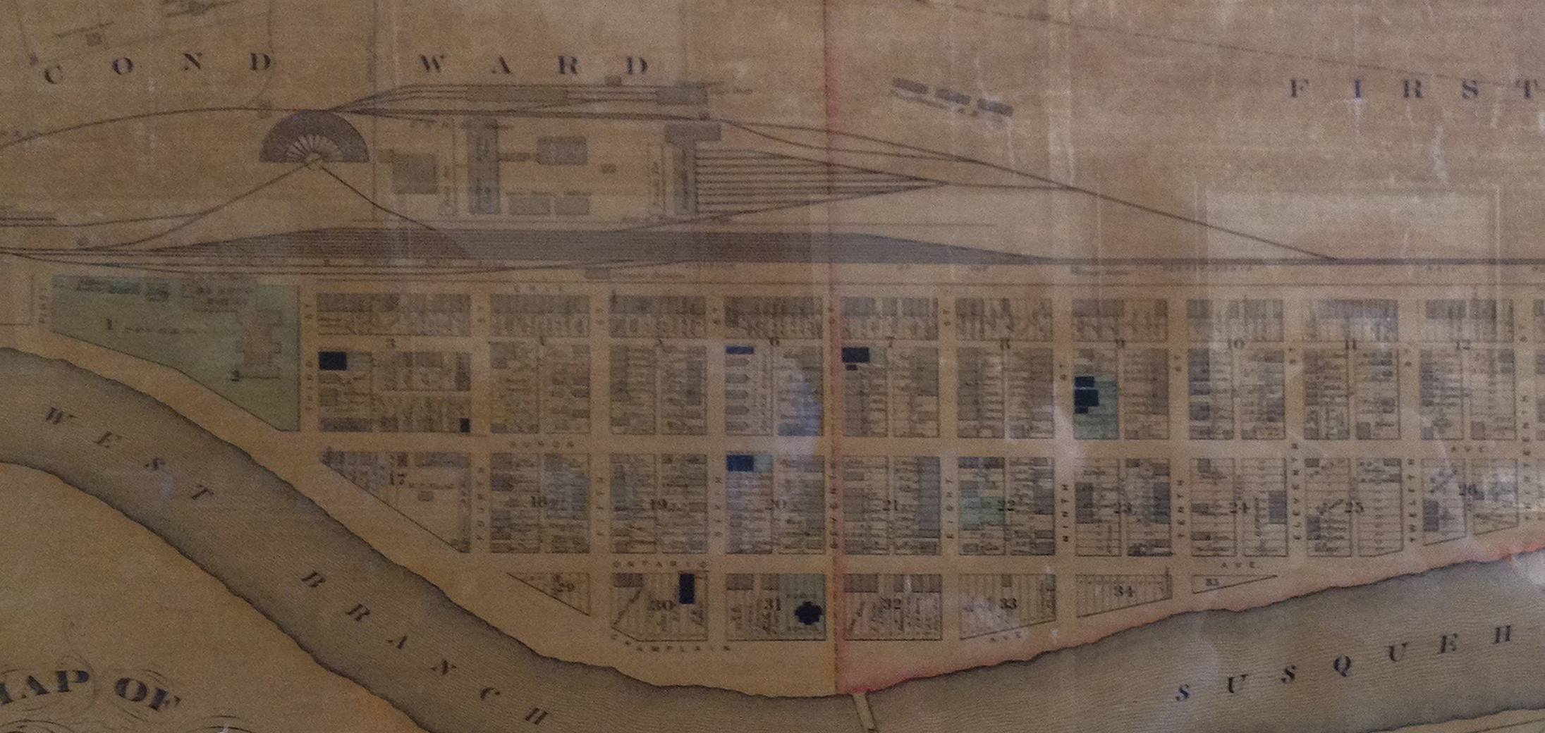
So far, in my head, my project will focus on what Renovo looked like geographically over the past 150 years, as next year the town will celebrate its sesquicentennial. Prior to being incorporated as a borough, the Renovo area was a hunting area for native Americans. I’d like to include a map of the Sinnemahoning Path, which crossed through Renovo and follows the West Branch of the Susquehanna River and PA Route 120, to highlight how this path is still being used today. I also want to see how the old railroad lines matched up with this path and see how they compare to the old travel routes.
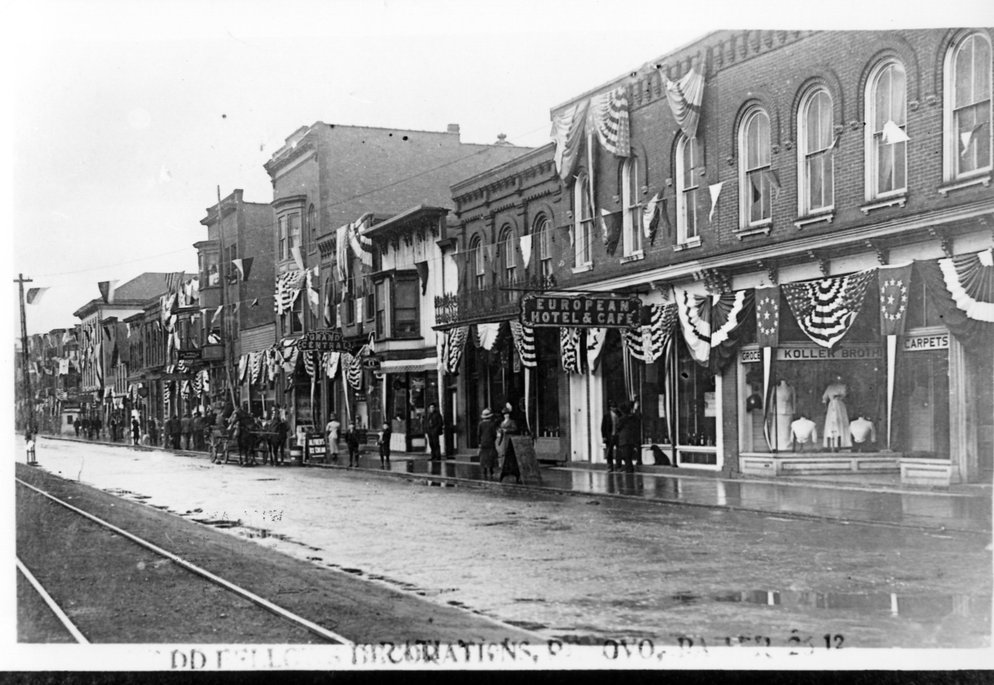
Another part of my project will hopefully utilize some of the software we’ve been learning or will learn, such as Natural Scene Designer and SketchUp. I’d like one section of the project to focus on Erie Avenue and the railroad by reconstructing what the area looked like in the early 1900s (1900 – 1915). I’ve been collecting images of Erie Avenue from this time period to help provide me with the details I’ll need for reconstructing. I plan on using the 1911 Sanborn map and making it look 3D with SketchUp. I’d also like to try a line of sight image of what Erie Avenue would have looked like as one exited a train at the passenger station at the end of the street in 1911. I also would like to feature Binder’s Brewery into my project by using the old Sanborn maps to show its transformation over the years. The brewery was located to the west of Renovo but still within the town limits. I’m thinking about including a modern day view of the town to compare/contrast the geography of Renovo with its historical counterpart, but I may be taking on too much. I think I can do it, though, I just need to plan. Right now I have my finished product all inside my head and need to transfer it to my sketch pad to see how it will turn out on paper.
I really like the idea of investigating the Sinnemahoning Path. I know of several branches near Driftwood that are still in use (in addition to the paved roads). It would be interesting to trace the importance of this route over time. The road is still the best (and really only) way to travel in that area. You might want to look at the county historical societies. The Elk County historical society contains some random photos of Driftwood and other locations outside of its limits. I am sure they are not the only one. There are also several old pioneer texts that discuss the region. They are out of print, but I have copies at my house. If I make it back home this semester I will grab them.