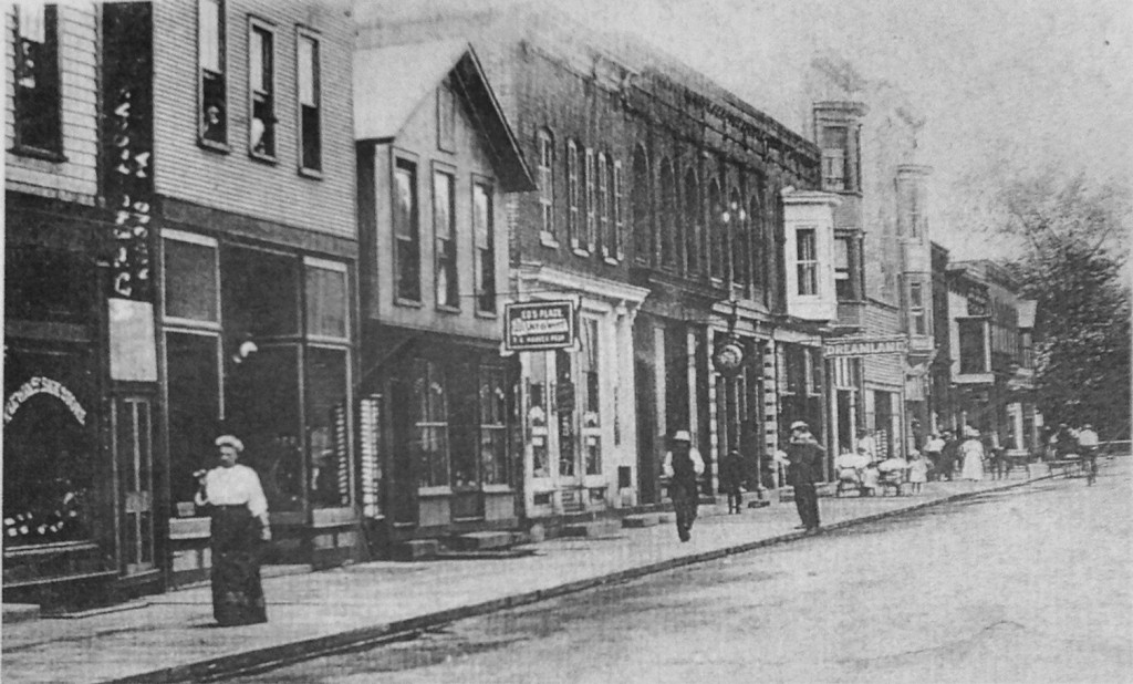
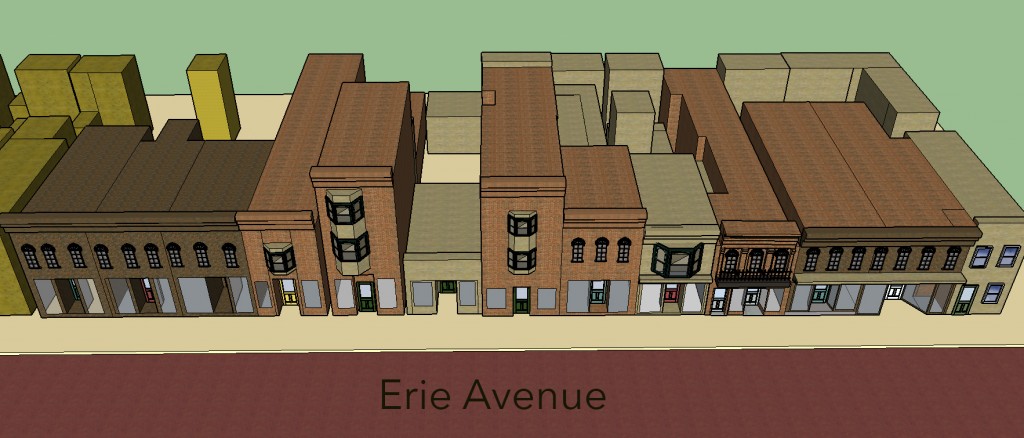
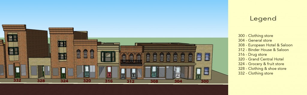
For this assignment, I went back to the 1911 Sanborn map of Renovo, PA and focused my SketchUp project on 3rd – 4th Streets of Erie Avenue. This block would be the first block visitors would see as they exited the railroad passenger station directly across 3rd Street to the west. I used a few photos that I had collected from friends and online sources to reference my SketchUp creation. I tried to be as detailed as possible, especially with the building at 312 Erie Ave, which was the location of Binder’s Hotel in 1911.
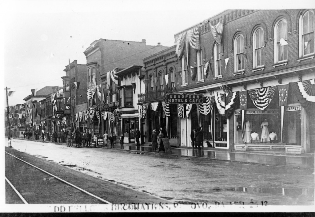
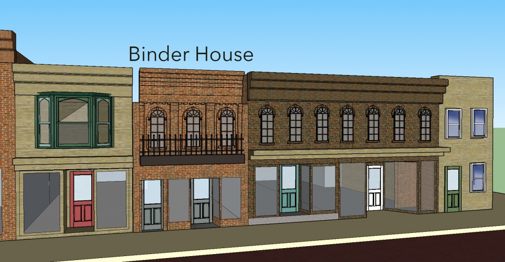
I have written in an earlier post about the Binder family, who emigrated to the U.S. from Germany in 1852. At least two of the sons, Luke (who was born in Germany) and Adolph (born in Pennsylvania three years after the family’s migration) settled in Renovo as adults to capitalize on the booming railroad industry. Luke purchased and operated a brewery until his death in 1898, as well as bought the building at 312 Erie Avenue in 1887. The building was originally built in 1872 by George Burger, the same man who sold Luke the brewery the same year. It was built as a hotel that could accommodate twenty guests and included a bar and restaurant as well. After Luke Binder purchased the hotel for $8000, he leased it for two years before his brother Adolph took over as proprietor, and opened the business under the name Binder House after making many renovations and improvements. By 1893, Luke, still the owner, built an addition to the hotel that would extend from Erie Ave. to St. Clair Ave. The hotel would stay in the Binder family until at least 1925.
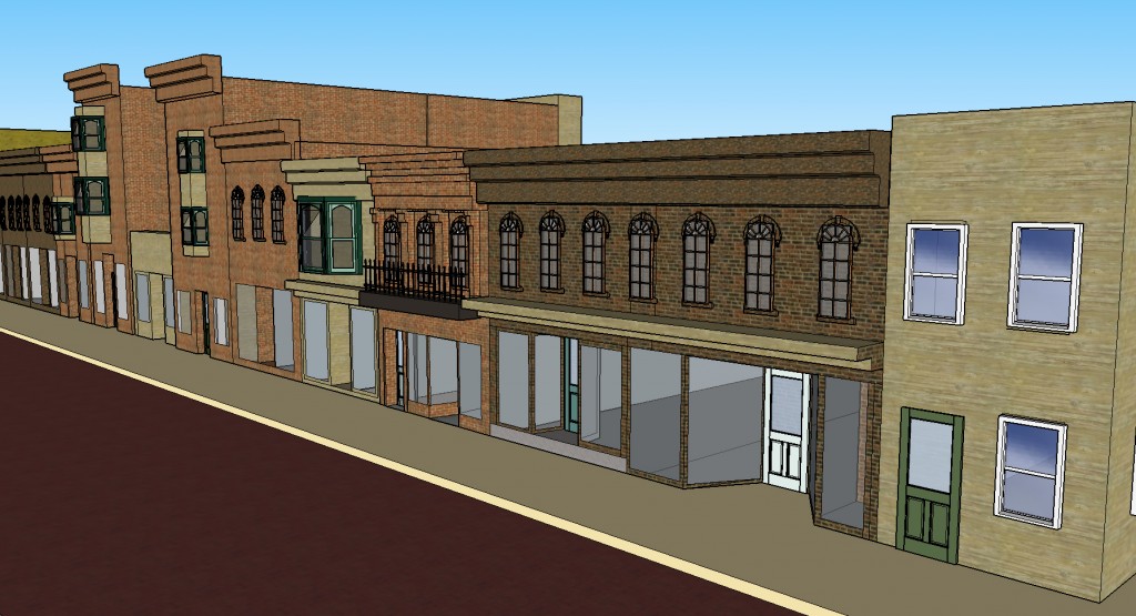
The building no longer stands, as most of this block has either burned down or fell into disrepair over the years. After the railroad closed the repair shops across Erie Avenue in the mid-20th century, the population dropped and businesses closed up shop. Compared with the 1911 Sanborn map, the modern day Google Earth View of the block looks sparse. I wanted to use SketchUp to recreate some of the buildings that have disappeared and to show the contrast in the density of the block.
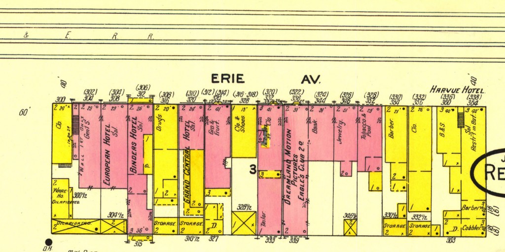
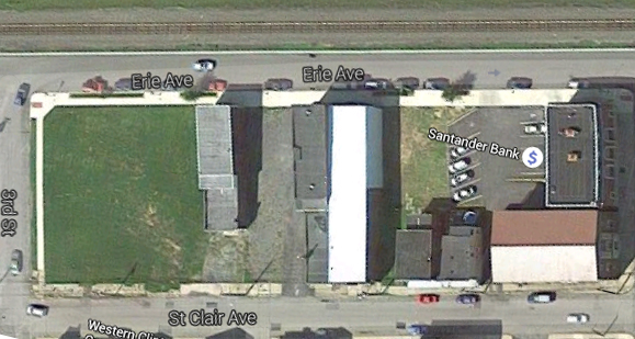
I was unable to finish the entire block in time to post this, which I regret, as those buildings have been replaced with a large brick bank and parking lot. There are lots of other features that I would have liked to include as well, such as people and trees to make the street look more bustling. I should have included the railroad tracks on the opposite side of Erie Ave, but the resulting views replicate what rail passengers would view upon entering the town. I really enjoyed working with SketchUp and will attempt to continue to work on finishing the block for my final project. I tried to follow the Sanborn map descriptions as much as possible, while also using photographs from the early 1900s. I used red brick for the street as that was the type of material used before it was covered with asphalt.
I took a few screenshots of the SketchUp that you can view below:
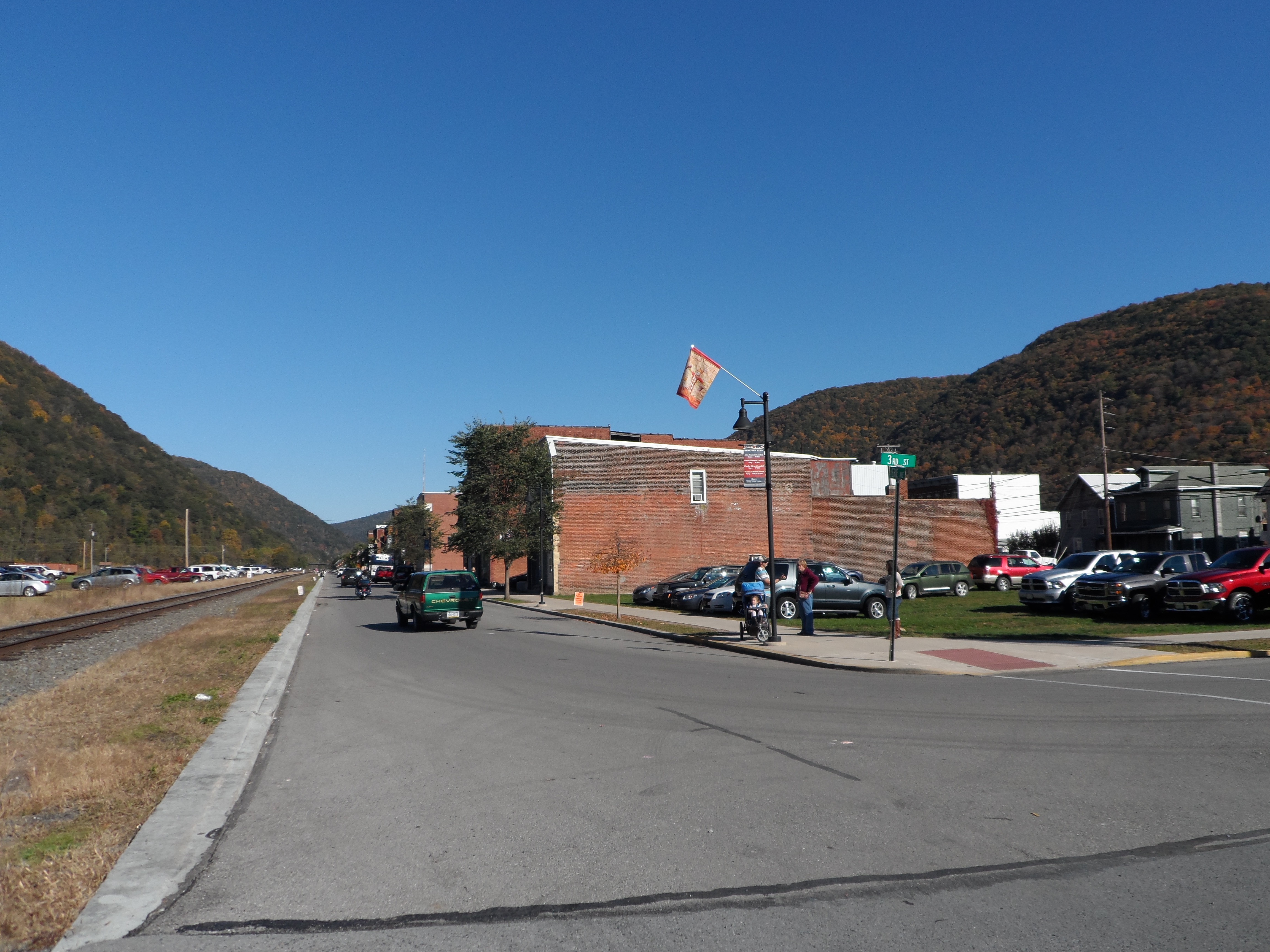
This final image is a photograph I took in October after the annual Flaming Foliage parade, which explains the cars parked in the grass and behind the railroad tracks. You can see the current street view of the same area in the picture, as well as my mom, sister, brother-in-law and my nieces waiting patiently for me to get the photo. The first building on the street is 320 Erie Ave, as the first five structures have been demolished over the years, including the old Binder House.
References: